
Winter Storm Damage blog statement
Subsequent to the severe storms this past winter many woodland paths and tracks remain impassable. In some cases the damage is so severe that the areas are closed for any kind of extended walking. In the coming months I will revisit as many walks as possible and update the blog accordingly. Please do not assume that walks are available as described and obey any closure signage you encounter on the ground.
Maps and photos note: click or tap to see any maps or photographs below as a high resolution version.
| TYPE | Largely circular forest track walk through conifer plantations with some excellent views, vistas and a short path section to visit a waterfall. |
|---|---|
| DISTANCE | 3.9 miles / 6.2 km |
| SURFACES | Mainly well made forest tracks with short section on good quality path with some climb and steps |
| HEIGHT GAIN / LOSS | 820 feet climb |
| HAZARDS |
This is a fully waymarked walk which already has a description and map available on the Marble Arch Geopark website. Like many of the Geopark walks it is contained within conifer plantation and largely confined to forestry vehicle tracks. However, it features great panoramic views and framed glimpses of the loughs and hills of Fermanagh. There is also a short forest path section which leads through an intriguing rock valley to to Blackslee waterfall – an abrupt hidden drop almost totally shrouded by encroaching woodland.
Getting There

Blackslee is part of the much larger Lough Navar Forest and the official walk starting car park is at Aghameelan Viewpoint on the the Navar Forest Drive. This is a well maintained asphalt forest road (largely one way) which extends for 7 miles through this upland conifer plantation. Bear in mind that the drive may be closed to vehicles from time to time (see Lough Navar page on nidirect) for announcements. An alternative would be to use the car park on the Glennasheevar Road at the start of the forest drive and carefully walk the 1.5km to the Aghameelan Viewpoint.
The easiest approach is come from Enniskillen on the A46 Loughshore Road and after passing Ely Lodge Forest look out for road signs to Forest Drive, Churchhill and Derrygonnelly on your left. Follow the brown signs to the entrance of Lough Navar Forest Drive and go along the drive for 1.5km to Aghameelan Viewpoint.

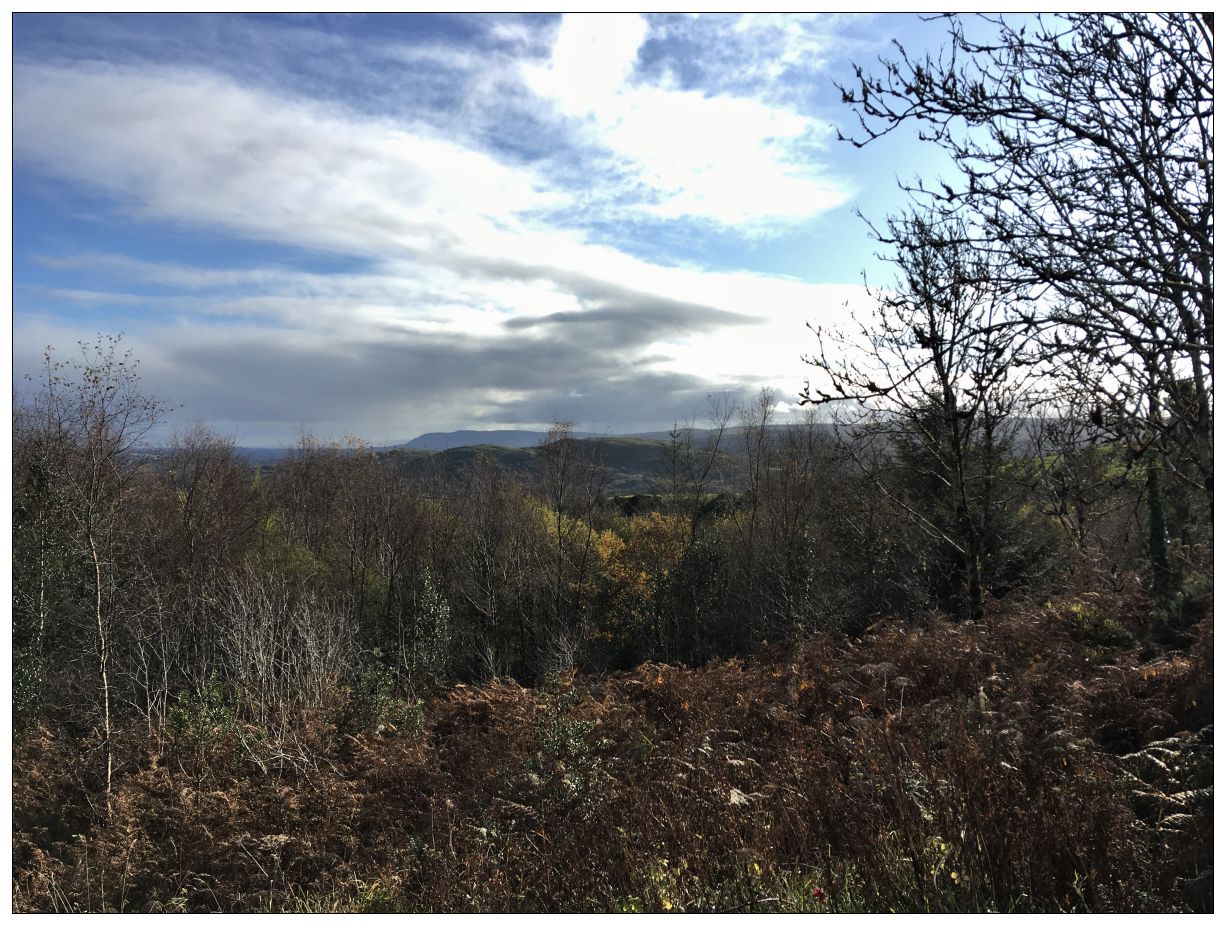
A major drawback to this walk is that you are likely to arrive at its spectacular high point, Aghameelan, by car – seldom a satisfactory way to get your head properly into a place or landscape. On the plus side you end here too, by which time you should be well tuned in and able to take full advantage of what I think is one of the finest views in Fermanagh.
The better known Cliffs of Magho viewpoint (further along the forest drive) has more raw spectacle in that you look directly down on much of Lower Lough Erne. However, here the landscape features are presented in unfolding layers. In the mid foreground Carrick Lough sits with its crannog and ancient ruined church in the wooded hill behind. Behind and to the right the tiny Doagh Lough sits isolated in low hills. To the right is Lough Bunnahon and beyond a glimpse of Lower Lough Erne. The far horizon to the left features Topped Hill (another great viewpoint beyond Enniskillen town), in the centre Knockninny (20 miles away on the edge of Lower Lough Erne) and to the right Belmore Mountain.
The Route
The waymarked route starts by accessing a strange small path on the left of exit of the car park which briefly climbs before dropping back and crossing the road. Presumably this is to protect the walker from traffic hazards but seems rather disproportionate to the risk involved!

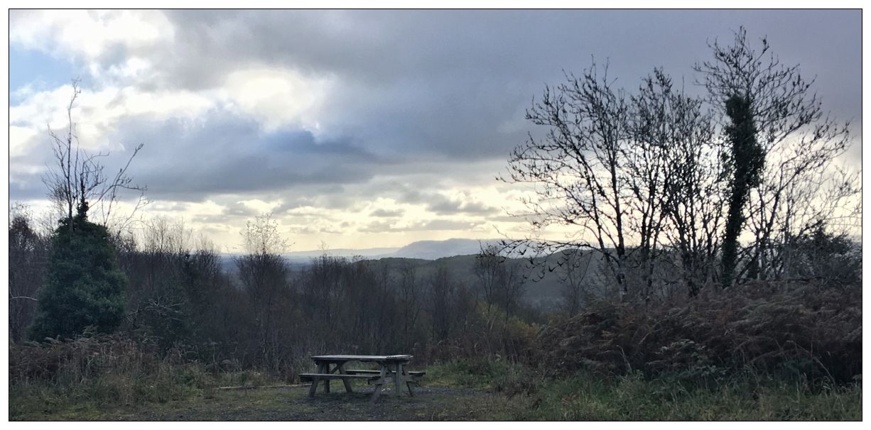
Once across the asphalt road you are onto normal forest roads which will make up the great majority of the route. After 150m the track widens and there is a picnic table to your right with a a partial view behind. This could be a spectacular car free viewpoint, but rapidly regenerating woodland will soon remove the view completely if management does not occur.
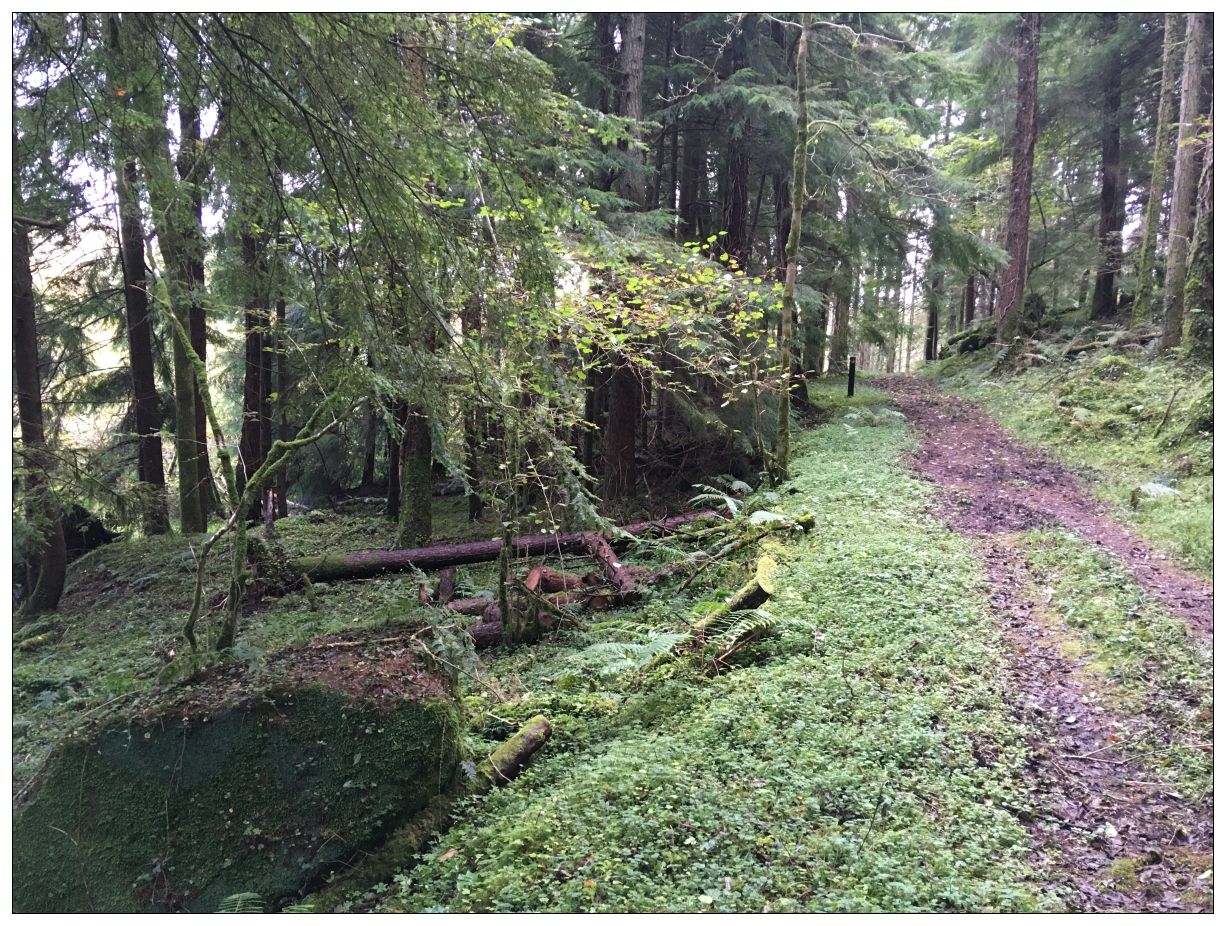
Continue on to the next track junction where you follow the black waymark left uphill. Like most commercial conifer forestry there is little obvious natural interest under the close packed canopy where light is very limited and a needle carpet suppresses forest floor vegetation. However, nature always tries to find a way, and the sheltered lighter corridors along the forest track often support a good range of grasses, mosses, naturally seeded scrub with associated bird and other life – so keep watching!

After 600m the gradient eases and another track joins from the left. Keep to the right following the waymark. There is a recently felled area to your left which contrasts with much of the forestry on this route which seems to have been allowed to grow to an unusual level of maturity. Conifers like Sitka Spruce can be harvested in a little as 25 years, but can actually live for hundreds of years. The Sitka Spruce is actually the fifth largest conifer in the world and ranks close to the much revered giant redwoods. Allowing forest to mature to a greater age increases their carbon capacity, wildlife and indeed recreational value. Fortunately there are some hopeful signs and the use of forest thinning rather than clear felling is making a welcome return to Forest Service practice. One significant obstacle to conifers approaching maturity is the natural ‘felling’ through storm damage where trees on thin soil get blown over. Perhaps the hills and valleys of Blackslee provide some protection from this.
As you proceed you will pass a bench on the left of the track facing a stand of mature trees and an overgrown forest ride (linear gap between trees). Presumably there was once a view along this line.
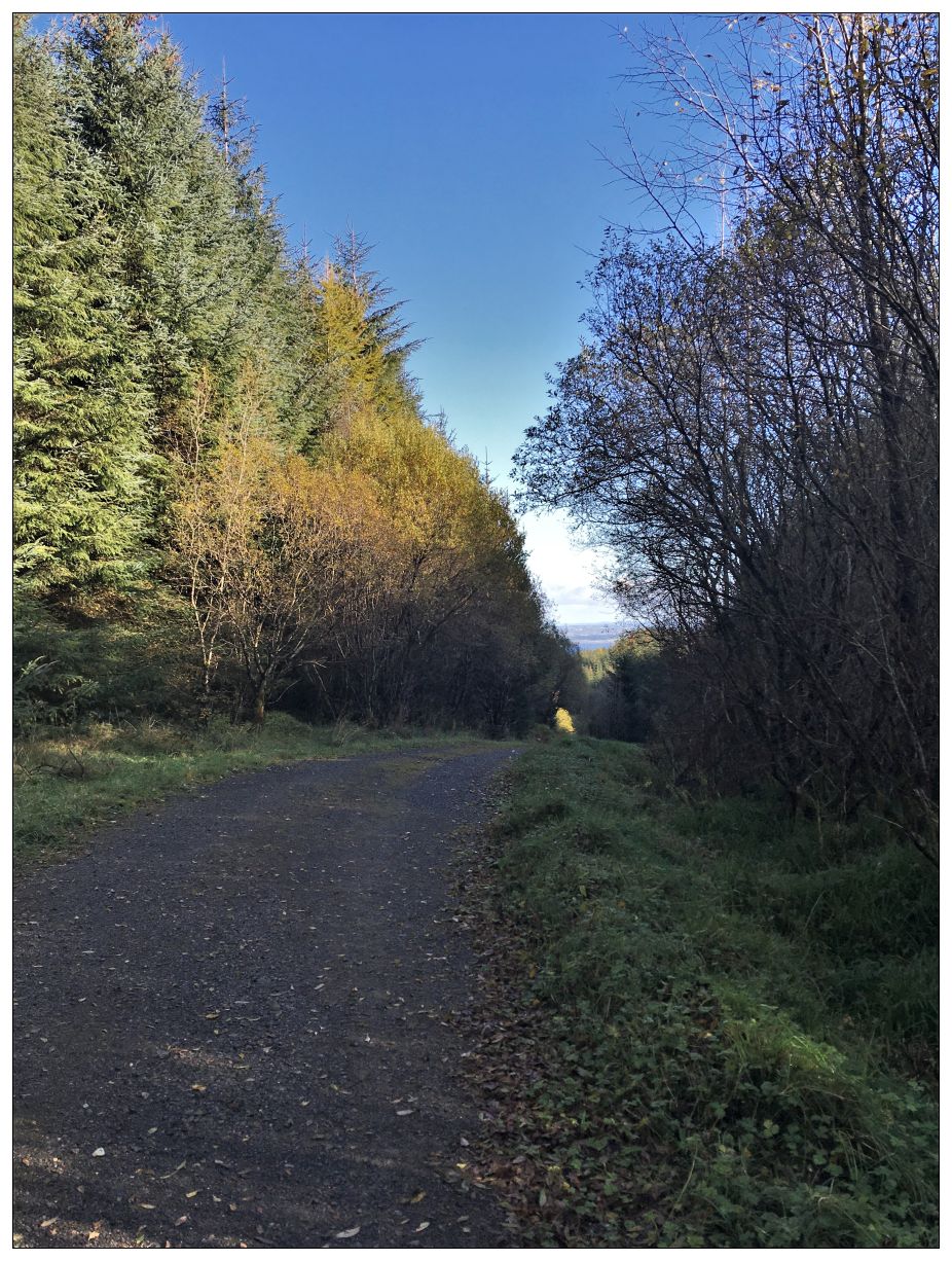
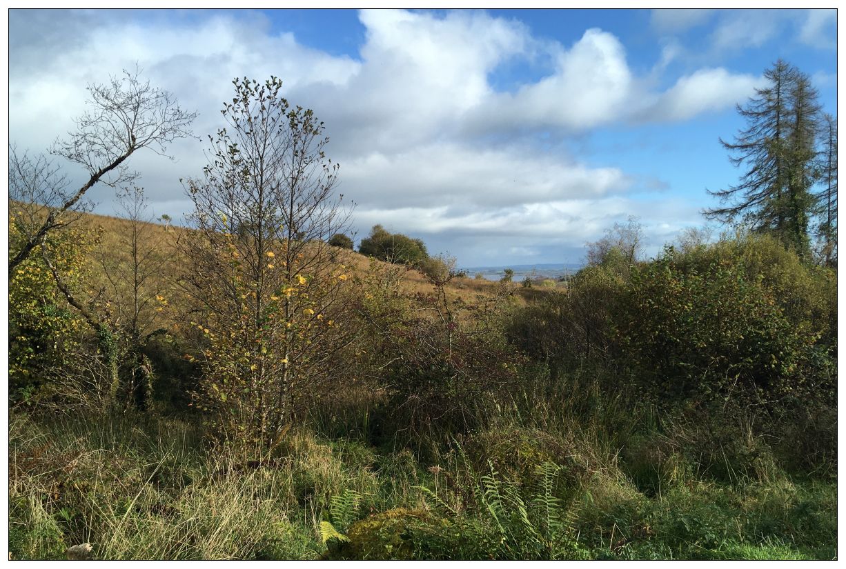
The track now bends and begins to drop as you join a stream valley formed between the Blackslee hilly promontory and the main Navar plateau. You are now heading directly towards Lower Lough Erne and soon a tunnel view – a Glimpse of Erne appears. In times gone by such a linear constrained view would have been called a vista and would have often been deliberately contrived by landscape architects. Today the term is often used interchangeably with panorama and so the power of language is reduced.

As you descend the valley the slope to your left steepens, conifers give way to scrub and natural regenerated woodland and rocky outcrops appear. This is a section of the Blackslee Dyke, a rib of hard ancient magma, originally extruded deep beneath the surface but now exposed to light. These features occur in various sites in the Geopark, including near Cuilcagh Mountain as described in the post Marble Arch and the Marlbank Karst.

You will notice several other places in this walk where small area steep slopes, which render ground unstable for plantation, has allowed nature to ‘fill in’ small blocks of natural woodland.
As the valley begins to widen you come to a track junction and turn sharp left and uphill to climb over a low spur into another Lough-facing shallow valley.

As the track hits the elevated forest edge you come to a seat with a seriously good view. Walkers (and runners and mountain bikers) in my experience tend to eschew such sitting opportunities thinking them only for the old or less fit. Their loss I suggest – what is the great outdoors if not somewhere to stop, be still and drink in the richness of life all around.
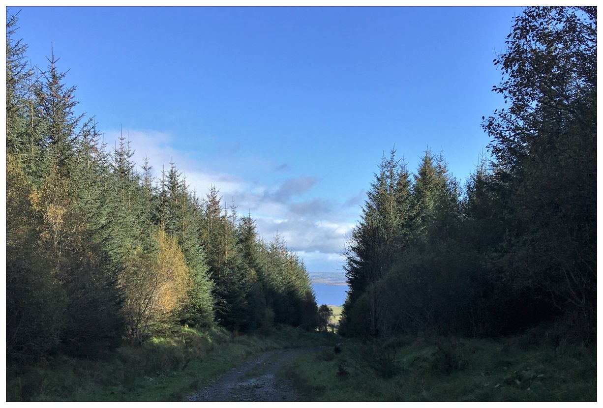
Continue leaving the rather odd ‘dual carriageway’ at the corner behind. The path swings right uphill again crossing a spur (lake glimpse behind).

You now drop down directly towards the high spur of Blackslee where the steep slopes have again been colonised by native species.

As the track swings left you return to the forest edge. The boundary here is soft and ill defined. Open, lightly grazed, wet mountain merges into encroaching scrub, natural woodland and plantation edge. The OS map from 1860 shows this whole area as largely open rough farmland, but in 2019 much of this area is gradually being transformed into scrub and woodland as actively farming the margins becomes progressively unrewarding.
Ahead a superb stand of mature larch trees cloak the higher ground.

You now come to a track cross roads where you turn left onto a dead-end track towards a stream and forest boundary.

At the end of the vehicle track a waymark post points right onto a well defined footpath.
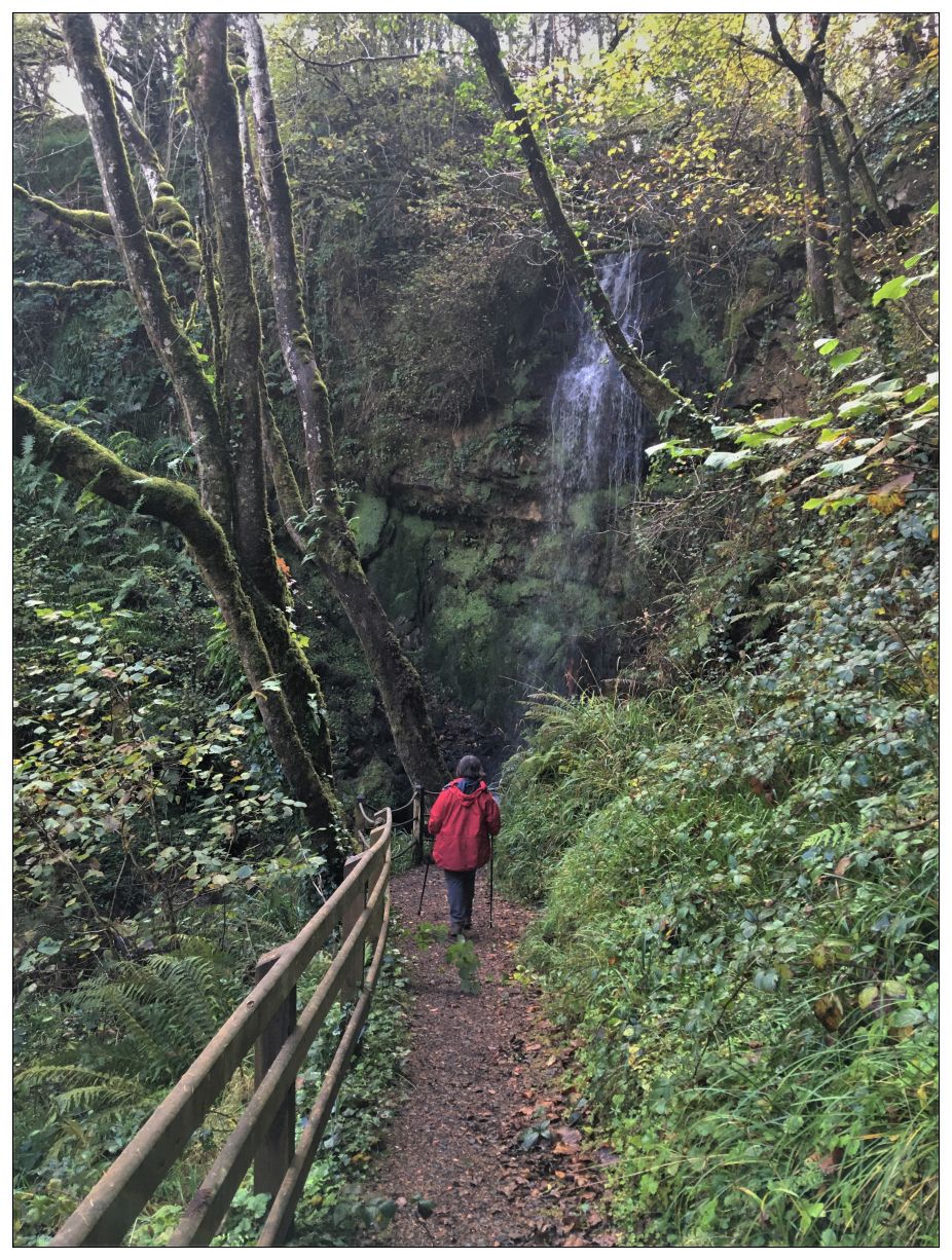
For the next 300m you weave along the valley floor with a small stream to your left and natural woodland beyond. The path then climbs, via steps, to a junction.

The left fork leads to a small viewing platform below the waterfall.

The stream which tumbles over Blackslee fall is not large and there is no great valley gorge like at Glenariff. What is remarkable here though is the abrupt transition from a gentle, almost level, meandering stream to a steep plunge, as a change in the rock type allows sudden dramatic downward cutting – a sudden cliff appears from nowhere!
Return to the path junction and climb up above the cliff to a lovely area of mature conifer forest where you will find ‘Cloud Viewer’ – a willow paled enclosure surrounding a single shoring tree with a circular seat. Here you are encouraged to sit, look up and take in the sky and clouds above.

Continue though this lovely piece of forest and rejoin the forest road network turning right.

The forest is mature and it is possible to glimpse the undulating nature of the landscape with steep sided high points on both sides of the track. The Northern Ireland Site and Monuments Records database lists three raths in this immediate area all of which also appear on the 1830 OS map as clearly defined ‘forts’ on small hills in open ground. The nearby Bunnahone and Carrick Loughs also contain multiple crannogs. This complex landscape of small hills and valleys has long been inhabited and defended.
Now follow the black trail slowly uphill parallel to the secluded pasture valley to your left (a few tantalising glimpses occur but unfortunately trees hide most of this semi-wooded landscape from view). You pass a track climbing to the right before crossing the stream (on its way to the waterfall) and, zig-zagging up, return to the track junction you passed by earlier. Go straight ahead and retrace your outward route past the picnic table viewpoint and the well marked road crossing.

Turn left and return to the starting car park.

Hopefully by now you will see the complex valley below and the hills beyond a little differently. Maybe just because the light and weather will have changed, but perhaps as well because you have seen hints and glimpses of a changing complex landscape.
